Madeira is a hiker’s paradise — thanks to well-marked trails, microclimates resulting in varied environments, and the island’s many waterfalls, tunnels, and small waterways known as levadas.
However, with so many options, it can be difficult to choose your hikes. When we were first exploring Madeira, we found lists such as “the best 60 hikes in Madeira” not the most helpful. (Wait, all sixty are the best? And who has time to do that many hikes on one trip?!).
We thought we’d keep things simpler by telling you four types of landscapes you can enjoy in Madeira, along with some suggested trails for each.
In this article…
How to get to the trailheads
Firstly, a practical matter: how can you reach the hiking areas in Madeira?
Several hikes can be reached by public transportation. For example, you can get to São Lourenço using Bus 113 (SAM) in Funchal, which takes about 90 minutes one way. Or you can take bus 81 from Funchal to Lombo Chão and hike in Curral das Freiras. On weekdays this bus goes about once an hour.
However, without your own transportation, most trails are hard or impossible to get to. The buses typically go to urban centres, not the more remote locations where trails usually start. Therefore the best way is to rent a car in Madeira so you can have complete freedom to hike anywhere.
If that is not an option, then booking a guided hike is your best bet. This will include a pick-up from your hotel and a guide who can tell you interesting things about the island and its ecology.
Top guided hikes
All these tours include pick-up, transportation, and guides.
 Levada Walk in the Rabaçal Valley Arguably the most popular levada hike in Madeira which takes you to the area of the ’25 natural springs’.
- Pico Arieiro to Pico Ruivo The most epic mountaintop experience… you’ll get to walk above the clouds!
- Laurisilva: Walk with Local Mountain Guide Learn about the ancient laurel forests from a local expert.
- Fanal Levada Walk Visit this magical forest that’s almost always shrouded in mist
Best hikes in Madeira
Due to being in the middle of the Atlantic Ocean, Madeira has various microclimates resulting in highly varied landscapes. You’ll have several very different hiking environments to consider!
Generally speaking, the south side of the island is a lot drier and sunnier. In the far east and far west, it’s more often completely open without any tree cover, in strong contrast to the lush forests elsewhere.
The north side of the island is overall a lot greener, as clouds from the ocean get trapped here against the central mountain range. It’s fantastic hiking territory, but do bring a rain jacket just in case!
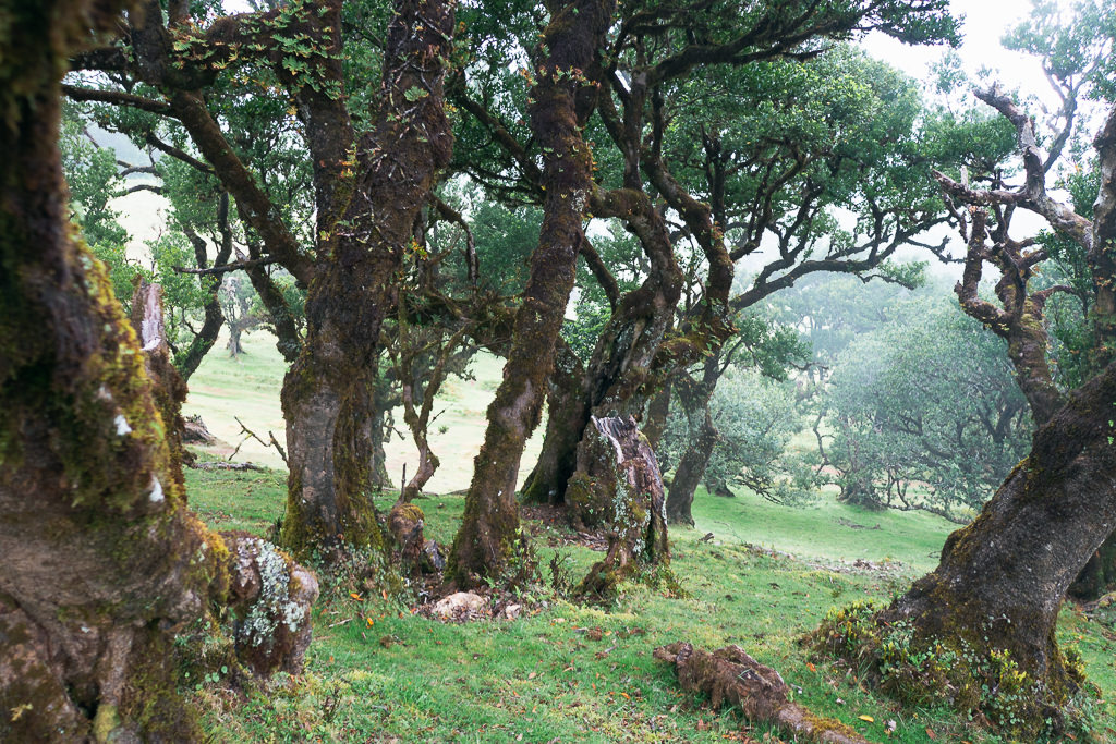
The north is home to one of the largest surviving laurel forests, a type of primal forest that covered much of Southern Europe millions of years ago. These laurel forests show off a lot of endemic and rare plant life and trees and make for some particularly unique hiking environments.
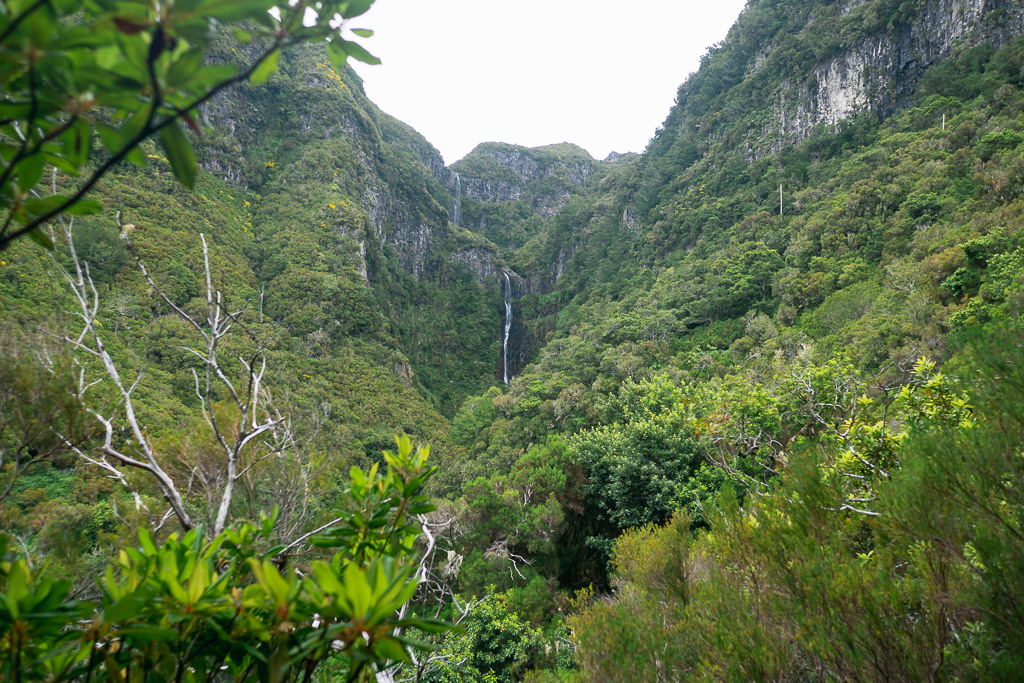
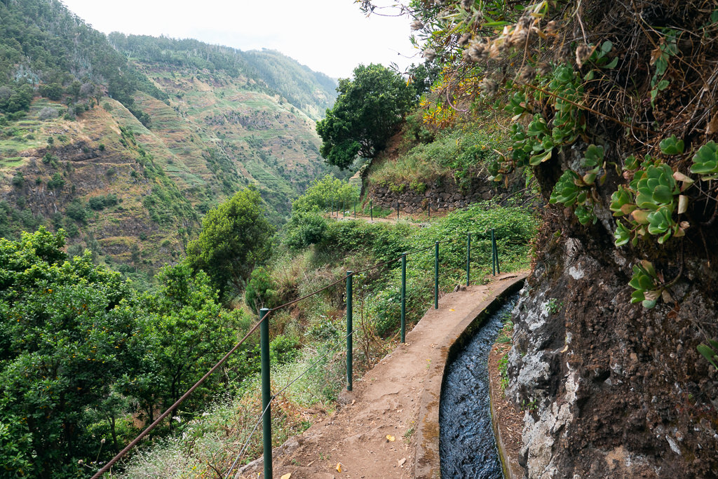
1. The levadas
When you visit Madeira you must do at least one levada hike!
The mini aqueducts known as levadas intersect the island, bringing some of the excess rainfall of the north side to the much drier south. Totalling over 800km, the construction of the levadas goes back to the 15th century when Madeira was first settled.
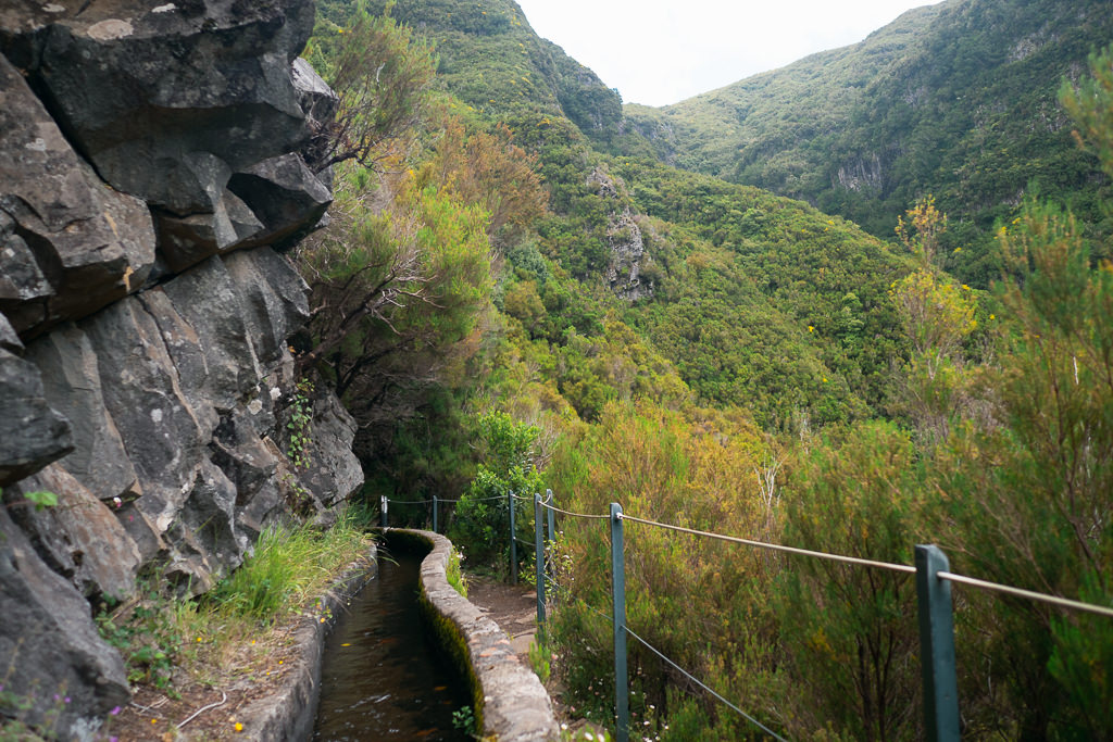
The narrow paths along the levadas were initially intended to be maintenance paths, but over the years, they turned into hiking trails. Some of the trails go through small tunnels or even behind waterfalls as they make their way through the mountains.
There is an overwhelming number of them which can make it hard to choose, but among the most popular ones are the Levada das 25 Fontes and the Levada do Caldeirão Verde. These can get a bit busy, but they are fun and highly worthwhile.
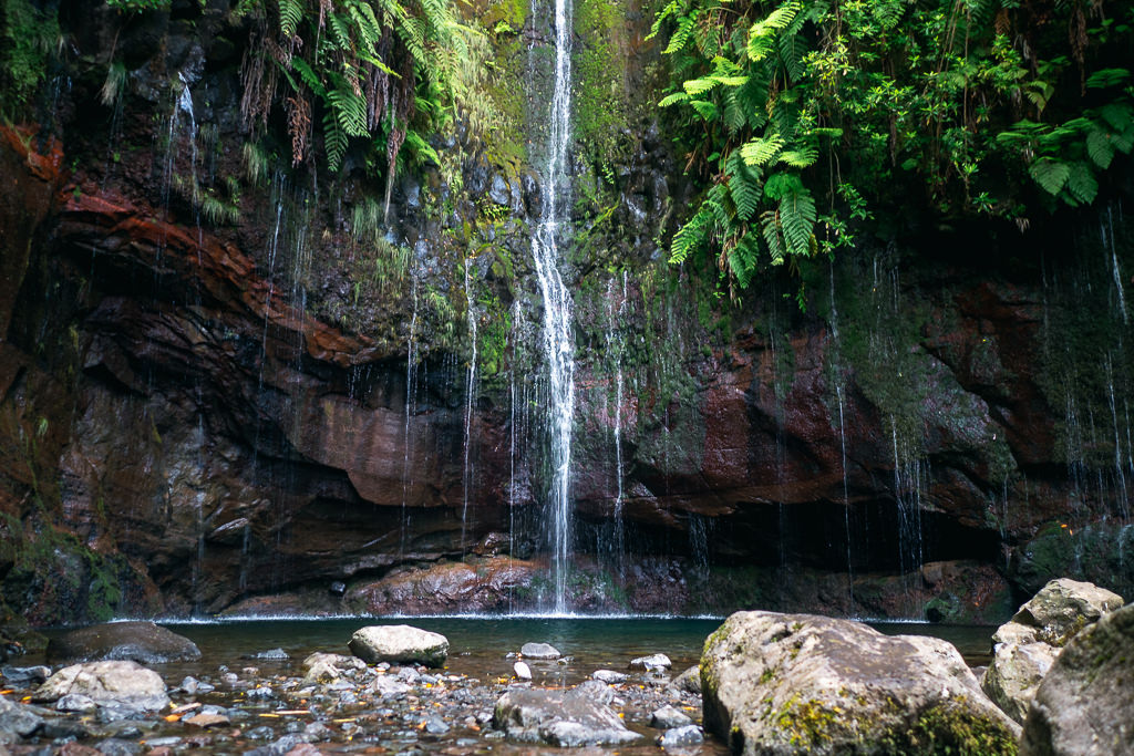
If you’re afraid of heights then a few of the levadas may be a bit challenging, as sometimes all that separates you from the cliffs is a thin metal rope. Some of the levadas may also not be ideal for small children. Thankfully the official trail descriptions will let you know exactly what to expect and there are trails for every level.
Looking for a less-visited levada hike? Read about the Levada do Moinho trail, one of our favourites on the island!
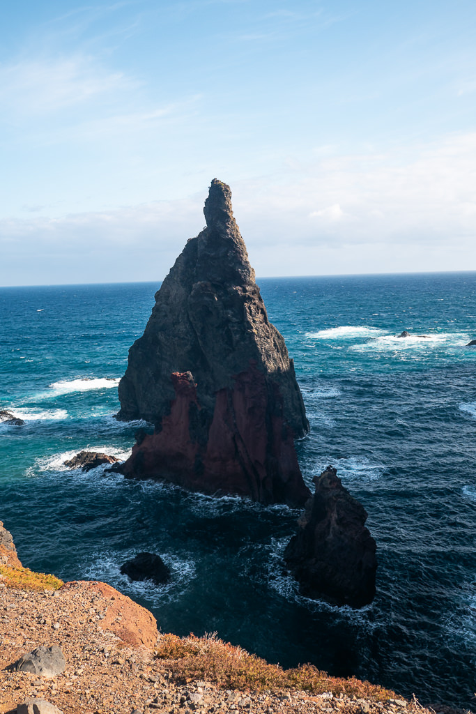
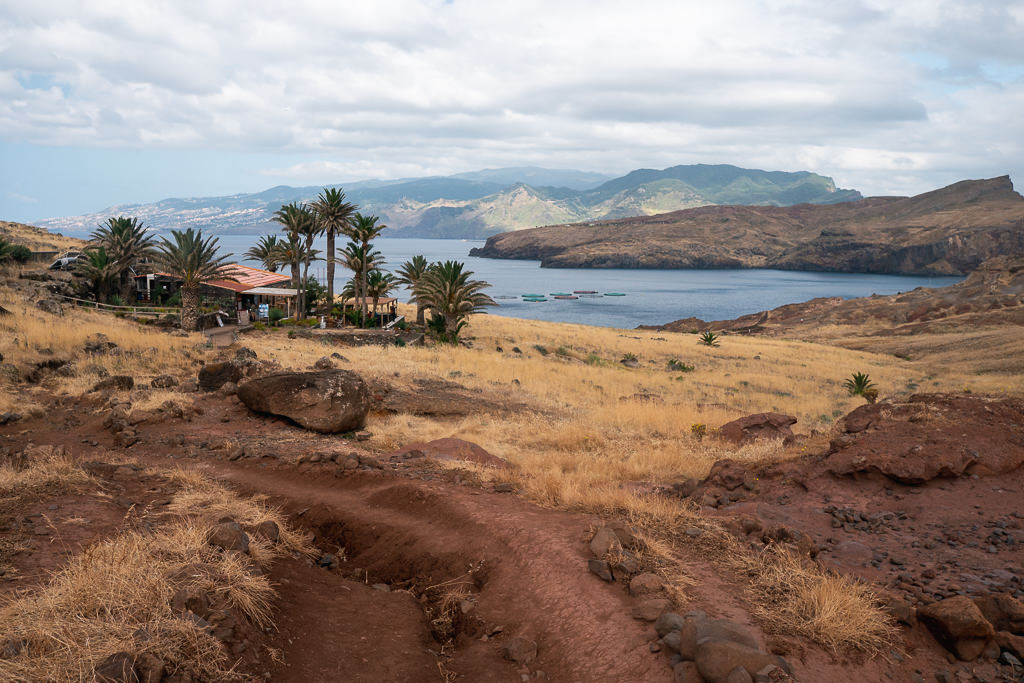
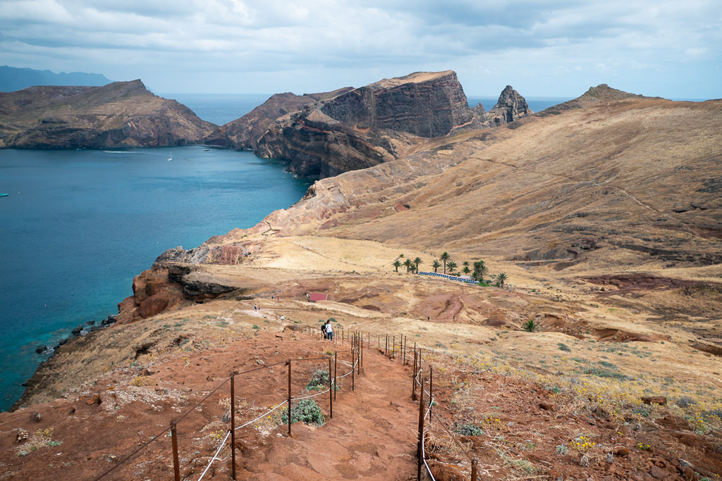
2. The open headland
The northeast peninsula of Madeira is typified by open space and gnarly seaside cliffs. It’s a completely different experience from the lush green interior.
This area is often featured in drone shots of Madeira and it’s certainly one of the best hiking areas.
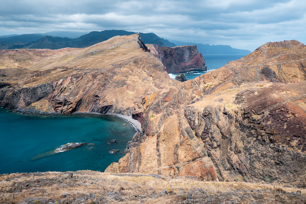
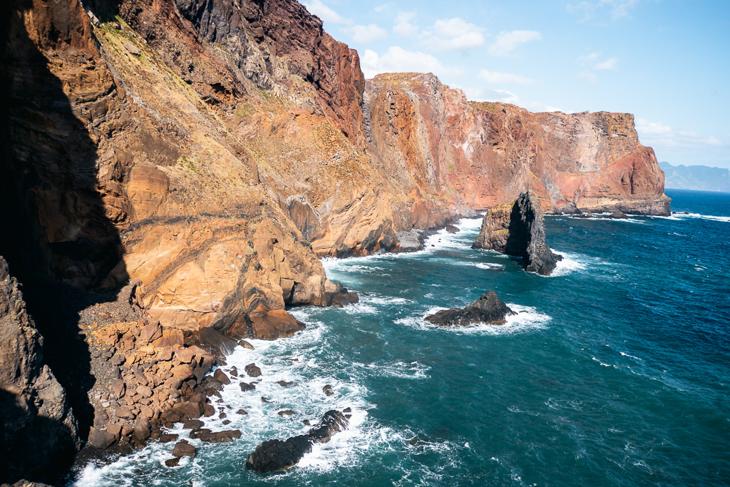
This trail is one of the few you can easily reach by bus from Funchal. The dry, eroded cliffs make for a very dramatic backdrop as you make your way to the furthest point with a view of the Sao Lourenco lighthouse.
The Ponta de São Lourenço hike starts at this trailhead east of the village Caniçal. From there, it takes about an hour to reach the isolated cafe called Casa do Sardinha (Sardine House), which is surrounded by palm trees.
Optionally, you can hike further from this point up to a gorgeous viewpoint called Miradouro Ponta do Furado which overlooks two uninhabited islets.
Since this area is very exposed to the sea, it can sometimes be rainy or cloudy while other parts of the island are sunny, so you may wish to check the weather before going.
Doing this hike in the early morning is a great experience, as the morning light is beautiful and the sun won’t yet be so hot in this highly exposed terrain.
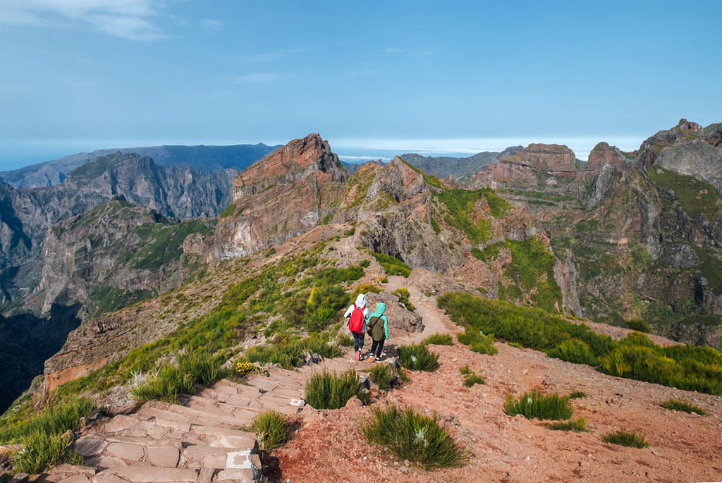
3. The central peaks
The central peaks are utterly stunning and (unsurprisingly) feature in many drone shots and in tourist brochures of Madeira. The most commonly walked trail here is between Pico Ruivo and Pico do Arieiro.
Pick a good day to do it when clouds do not obscure the views. You can check the island webcams for the conditions before you head off.
While this 10km trail is point-to-point and not circular, there are tour services in Funchal that can deliver and pick you up at the trailheads at specific times. You can also easily book a Pico do Arieiro guided walk at GetYourGuide, a platform that will connect you with local tour providers.
Some hikers try to catch the sunrise at Pico Ruivo, which will involve either sleeping there in a tent or getting up very early. It’s legal to pitch a tent at Pico Ruivo with prior permission from the tourist office, but it’s recommended to do so only in summer, as night temperatures can be very cold even during this time of year. With Pico Transfers you can book a transfer to the campsite and back.
For an easier version, you can start in Achada do Teixeira and hike up to Pico Ruivo from there. There is an amazing cafe/restaurant at Achada do Teixeira where you can grab a coffee or something delicious to fill you up after a stiff hike.
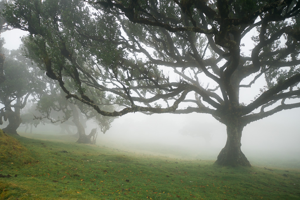
4. The misty forests
The northwest area around Fanal seems almost perpetually shrouded in fog as trade winds push clouds against the central mountains.
The knobbly trees in the mist make Fanal look like a spooky forest, especially with the chorus of frogs croaking from the ponds creating even more of an enchanted feel.
There are several point-to-point trails here, but you can also just park your car and wander randomly for a while. Just bring your phone in case you get lost in the constant whiteness!
Be sure to bring a coat and long trousers as even in the summer the temperatures drop considerably in this magical cloudy forest.
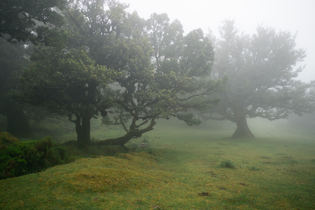
Even if the weather where you’re staying is completely sunny, it can easily be very different in Fanal. You still have to be lucky to see it in the right conditions. But even if the skies are blue when you arrive, waiting half an hour can be worth it as the weather at Fanal can turn on a dime.
Tips for hiking independently
The official site of Madeira does a great job listing all the marked trails and their levels of difficulty. It’s worth reading the descriptions as they may contain warnings about the suitability of certain trails. Due to the narrow mountain paths, some trails are not recommended if you are very afraid of heights, or they could be a bit dangerous in bad weather.
Most hiking trails are rated easy, however. You don’t need to be an experienced hiker to enjoy the wildly varied natural environments on the island.
Trails sometimes get closed for safety reasons. You can check the status of all official trails here.
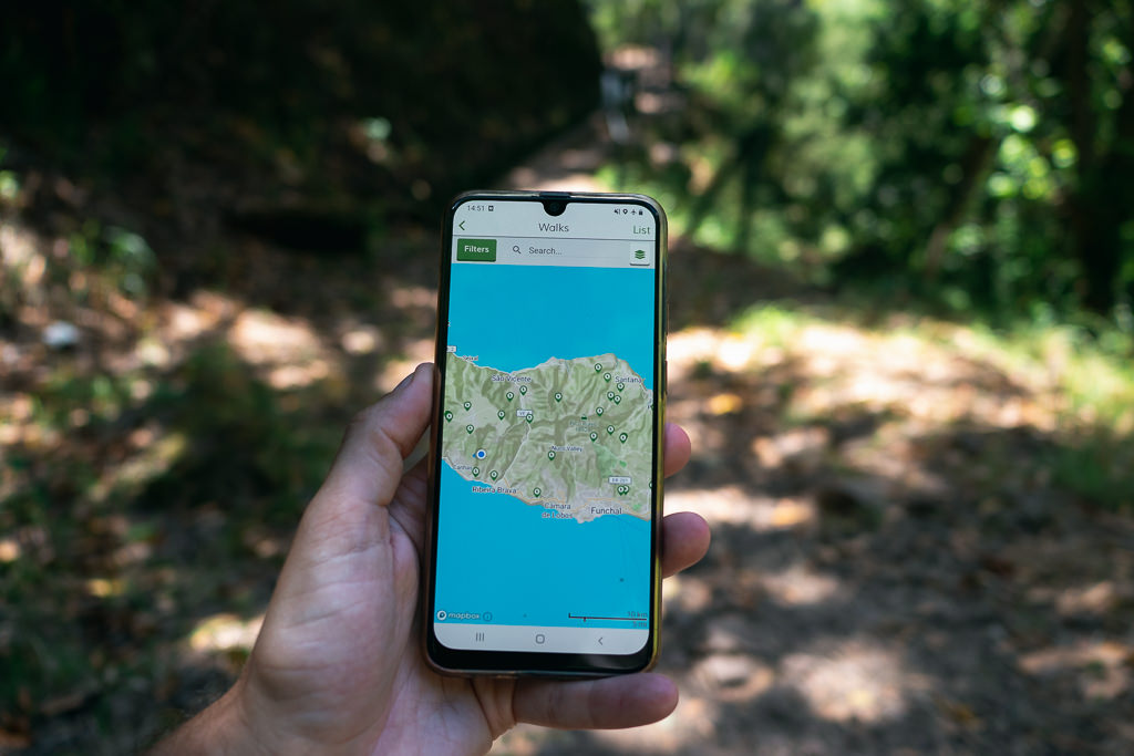
The official trails are all very well signposted, but you may still find it useful to have a map. The Maps.me app has offline maps that include hiking trails. You can also download the WalkMe – Hiking On Madeira app which was created by locals and has detailed information and GPS tracking.
It’s also a good idea to get the WeatherMadeira app, which offers local weather forecasts and live webcams that are much better than general forecasts on Google and such. Due to the many mountains and microclimates, the weather can change very easily and can be highly localized.